Feeds:
Posts
Comments

Archive for October, 2009

“““

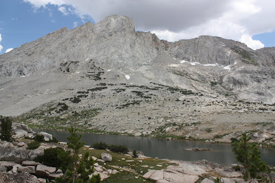
Locations: John Muir Wilderness, Dutch Lake & Hidden Lake

Dates: October 10, 2009 – October 11, 2009

Hikers/Fishers: Colin & Nick

Photographers: Nick (unless otherwise noted as Colin)

Colin and I decided to head out into the John Muir Wilderness for a brief weekend hiking and fly fishing trip. I recently tore my meniscus as well as additional cartilage damage, and Colin currently has a leg like the terminator resulting from a broken tib/fib/ankle accident at Squaw last winter.

Needless to say, we are both gimps but wanted to get out of dodge deep into the Sierra. The result: Kaiser Pass Road. Kaiser Pass Road is a seasonal, single-lane paved road that ventures up to Thomas Edison Lake and Florence Lake. Sitting at approximately 7,500 ft., Florence Lake is accessible by car but serves as a jump-off point for several trailheads.

(more…)

Read Full Post »

““

Locations: Conness Creek, Roosevelt Lake, Yosemite National Park

Dates: July 31, 2009 – August 2, 2009

Hikers: Andrew, Jared, Kevin, Matt & Nick

Photographers: Nick (unless otherwise noted as Kevin)

Went on a 3-day, 2-night backpacking and fly-fishing trip in the high country of Yosemite National Park . Included trips cross-country through Conness Creek Drainage and up to Roosevelt Lake in the shadow of Mt. Conness.

(more…)

Read Full Post »

““

Location: School House Rock, Donner Summit

Date: July 25, 2009

Climbers: Jared & Nick

Photographer: Nick

School House Rock is one of the many climbing areas in and around Donner Summit in North Lake Tahoe. We got up to the base of School House Rock around 8:15. There was one party starting the first pitch of Junior High Crack and no one on Kindergarten Cracks.

After looking from below, Kindergarten Crack didn’t look too interesting (although I am sure it is fun), so we waited for Junior High Crack. Only had to wait about 1/2 hour because the guys in front of us were pretty fast.

Another group came while we were waiting and climbed Mary’s Crack.

(more…)

Read Full Post »

““

Locations: Sierra High Route

Date: Saturday, May 2, 2009– Thursday, May 7, 2009

Skiers: Geoff Clarke, Craig Dostie, Nori & Nick

Photographers: Nick (except where otherwise noted as Craig or Nori)

Synopsis: We were embarking on the Alpine Skills International (“ASI”) 2009 6-day Sierra High Route, from West to East. The trip would be lead by Geoff Clarke, an ASI Guide and former Chief Telemark Examiner for the PSIA.

The planned route crosses the Sierra Nevada over 9 high cols and passes, beginning at old Wolverton Ski Resort on the edge of Sequoia National Park and ending at the valley floor outside Independence (off 395). The planned route starts at approximately 7,200ft., climbs to around 10,000ft. and holds the line between 10,500ft. and 13,000ft., until dropping down on the Eastern side of the Range.

As discussed more in detail below, the night before the trip approximately 8-12” of new snow fell above 8,000ft. On the tail end of our second day, near Copper Mine Pass we encountered High avalanche conditions, forcing us to spend the night. When the conditions had not improved the next morning, we turned around to Table Meadows and set up a base camp – skiing some great lines for the remainder of the trip.

The ASI East to West group lead by Peter Leh was able to make the crossing as conditions had improved by the time they hit Copper Mine Pass.

(more…)

Read Full Post »

““

Locations: Matterhorn Peak – Skiers Dream Chute and East Couloir

Dates: Saturday, Sunday, March 28 – Sunday, March 29, 2009

Skiers: Frank & Nick

Photographers: Nick (except where otherwise noted as Frank)

Weather: Saturday was fairly warm, with highs in the 40s. Late Saturday night, the winds picked up (with gusts in the 40-60 mph range were we camped at approximately 10,000 ft.). Temps dropped to about 15 at night, and then Sunday the high was in the mid-30s.

Avalanche Conditions: We found the snow to be very stable. During the skin in through Horse Creek drainage, there were signs of past wet snow point release slides from earlier in the week. However, temps were not high enough to cause any concerns for wet instabilities.

The snow in the actual couloirs (both North facing) was a combination of some wintry pow, but mostly wind affected. On the ski out on Sunday, we found good corn below 10,000 ft..

(more…)

Read Full Post »

““

Locations: (1) Hall of the Gods, Indian Cliff Chutes and (2) Angora Peak to Angora Lake

Date: Sunday, March 8, 2009

Skiers: Frank, Colin D. & Nick

Photographers: Nick (except where otherwise noted as Frank or Colin D.)

Weather: Started out warm and partly-cloudy in the morning. As the day progressed, the skies became overcast, temps dropped and the wind picked up. Around 3:30 on the top of Angora Peak, wind was gusting strong out of the SW, W.

Avalanche Conditions: From the Sierra Avalanche Center: Near and above tree line on open, wind-loaded slopes 37 degrees and steeper, isolated pockets of MODERATE avalanche danger could develop on NW-N-NE-E-SE aspects. Below tree line, avalanche danger is LOW.

We found a stable snow pack. Some loose-snow sluffs on steeper aspects, but that was the only visible instability. On shaded northerly aspects, from boot to knee-deep soft powder. Lower elevations and southern aspects had a breakable crust.

(more…)

Read Full Post »

Location: Silver Peak, CA

Date:  Saturday, January 3, 2009

Skiers:  Colin & Nick

Photographer: Nick

Weather:  Clear skies, intermittent clouds, temps from 15-30

Avalanche Conditions:  LOW, with pockets of MODERATE on N-NE aspects over 37 degrees (from the Sierra Avalanche Center).  Our observations while skiing indicated a strong snow pack.  No serious sluffing or visible signs of slabbing.  N-NE aspects did have a slight rain crust about 6 inches down (from overnight rain on Jan 1st) with powder on top (from Jan 2nd storm).  S aspects had pockets of sun crust on the top by mid day.

(more…)

Read Full Post »